all things nature in Point Reyes

Abbotts Lagoon Trailhead

The Abbotts Lagoon Trail is a popular spot for wildlife photographers and a favorite trail of many people. Watch for migrating birds (and the local friendly song sparrows), river otters, bobcats, herons, burrowing owls, long-tailed weasel, and more. Something beautiful is always blooming here — wildflowers in the spring, cobwebby thistle and coastal hedge-nettle in the summer. Climb up the hill right before the footbridge for fabulous views overlooking the lagoon and ocean, and the best spring wildflowers.

Hikes

  • Hike to the footbridge (2 miles out and back), easy. The footbridge is where you’re most likely to spot the river otters.

  • Hike to the ocean (2.8 miles out and back), easy. After the footbridge, follow the lagoon shoreline for the easiest path to the ocean.

Parking

The Abbotts Lagoon Trailhead is located along Pierce Point Road approximately 20 minutes by car from the Bear Valley Visitor Center. The dirt/gravel parking lot is on the west side of Pierce Point Road 3.4 miles from its junction with Sir Francis Drake Boulevard. The parking lot can accommodate ~40 vehicles. A vault toilet is located at the parking lot.

Learn more

Learn more about this trail including Point Reyes National Seashore park regulations (bikes, pets, drones, etc.) on the Point Reyes National Seashore Abbotts Lagoon Trailhead page.

Bayview Trailhead

Perched at the top of the Inverness Ridge on Limantour Road, the Bayview Trailhead offers several loop options that follow the Inverness Ridge and go downhill offering coastal views. Two trails depart from this trailhead.

The Bayview Trail heads west downhill through bishop pine trees and coastal scrub to the Drakes View Trail and Muddy Hollow Road Trail. There are several options to make it a loop. The Bayview Trail has an eastern leg that follows Limantour Road to the Sky Trailhead connecting with the Laguna Trail along the way.

The other trail departing from this trailhead is the Inverness Ridge Trail. Take Inverness Ridge Trail northwest along the crest of the ridge to Point Reyes Hill, one of the highest locations within Point Reyes National Seashore. There are several loop options.

Hikes

  • Inverness Ridge-Drakes View-Bayview loop (or reverse it starting at the Bayview) (4.9 miles), strenuous

  • Inverness Ridge-Bucklin-Muddy Hollow Road-Bayview loop (or reverse it starting at the Bayview) (7.8 miles), strenuous

  • Inverness Ridge out and back (5.2 miles), moderate

Parking

The Bayview Trailhead parking lot is approximately 10 minutes by car from the Bear Valley Visitor Center. There is a small gravel parking lot with space for ~20 vehicles on the north side of Limantour Road 4.4 miles from its junction with Bear Valley Road.

Learn more

Learn more about this trail including Point Reyes National Seashore park regulations (bikes, pets, drones, etc.) on the Bayview Trailhead page.

Bear Valley Trailhead

The Bear Valley Trailhead is the most popular trailhead in Point Reyes National Seashore. Three trails depart from the Bear Valley Trailhead: the Rift Zone, Morgan, and Woodpecker trails. Six trails connect directly with the Bear Valley Trail offering many possible routes: Mt Wittenberg, Meadow, Old Pine, Baldy, Glen, Coast. Bear Valley has a visitor center, large shaded picnic area, and two toilets (one at the visitor center and the other in the gravel parking lot). Kule Loklo and the Morgan Horse Ranch are great for kids to explore.

Self-guided interpretive trails:

  • Earthquake loop paved loop (0.6 miles), easy

  • Woodpecker nature trail loop (0.7 miles), easy

Hikes

A small selection of the many possible hikes from the Bear Valley Trailhead.

  • (shorter) Rift Zone to the Vedanta Society Retreat Access Road out and back (2 miles), easy

    • The Vedanta Society Property, which the Rift Zone Trail enters ~1 mile south of the Bear Valley Trailhead, is only open to the general public from 8 am until 2 hours before sunset

  • Woodward Valley loop (13 miles), strenuous (PRNS website)

Parking

This trailhead is about an hour by car from San Francisco, the East Bay, and Santa Rosa, and about two hours from Sacramento. The gravel parking lot has room for ~210 vehicles. The paved lot near the visitor center has ~50 spaces. Parking is free. Download the Bear Valley Area Map (PDF), which shows the location of the trailhead parking lot relative to the Bear Valley Visitor Center. Pull-through spots are available for oversized vehicles, such as RVs and horse trailers, on the west (right) side of the access road just northwest of the trailhead.

Learn more

Learn more about this trail including park regulations (bikes, pets, drones, etc.) on the NPS Bear Valley Trailhead page

Bolinas Ridge Trailhead

The Bolinas Ridge Trailhead is at the northern end of the multi-use, dog-friendly 11-mile-long Bolinas Ridge Trail. The Bolinas Ridge Trail passes through pastureland in which cattle graze. 

Trails that connect with the Bolinas Ridge Trail from Sir Francis Drake Boulevard (north) to Fairfax-Bolinas Road (south) are:

Hikes

Choose the Bolinas Ridge Trail north end if you want plenty of sun or the south end for shade.

  • Sunny: Hike to Randall to experience the sunny exposed pasture of the north end of the Bolinas Ridge Trail, out and back (12.4 miles), moderate to strenuous

  • Shady: Start at the opposite south end of the Bolinas Ridge Trail and hike to the McCurdy Trail (6.6 miles, out and back) or Randall Trail (9.8 miles, out and back) to experience the redwood forest and chaparral end of the trail, moderate

Parking

The trailhead is located along Sir Francis Drake Boulevard 1.1 miles east of Olema and approximately 5 minutes by car from the Bear Valley Visitor Center. Space for parking consists of an approximately 300-foot-long paved shoulder and an approximately 200-foot-long gravel shoulder along the sides of Sir Francis Drake Boulevard. Space is limited.

Learn more

Learn more about this trail including Point Reyes National Seashore park regulations (bikes, pets, drones, etc.) on the Bolinas Ridge Trailhead page.

Bull Point Trailhead

The Bull Point Trailhead is easy to miss. It’s located on the left side of Sir Francis Drake Boulevard as you drive toward the lighthouse/Drakes Beach. Look for the wooden trailhead sign and the small gravel lot. It’s right before North Beach on the opposite side of the road. This trail leads through pastureland to the edge of Drakes Estero. You will likely cross paths with curious cows. This trail offers rare plants and butterflies in summer and you will usually see at least one Northern Harrier flying over the water. The trail can be difficult to follow. Grasses get overgrown and hide the trail and cow paths diverging in different directions can easily lead you off the trail. If you find yourself lost, follow the sound of traffic back to Sir Francis Drake. Without any trees obscuring your view, it’s easy to get your bearings. Parts of this trail may be muddy, especially as you approach the edge of Drakes Estero.

Hikes

Parking

The Bull Point Trailhead parking lot is 25 minutes by car from the Bear Valley Visitor Center. There is a small dirt parking lot with space for 10 vehicles on the east side (the left side if you are driving toward the lighthouse) of Sir Francis Drake Boulevard.

Learn more

Learn more about this trail including Point Reyes National Seashore park regulations (bikes, pets, drones, etc.) on the Bull Point Trailhead page.

Chimney Rock Trailhead

Chimney Rock is one of the most scenic trails in Point Reyes. Several destinations are within an easy walk from the parking lot: Chimney Rock Trail, Elephant Seal Overlook and the historic Point Reyes Lifeboat Station on Drakes Bay. Chimney Rock offers panoramic views of Drakes Bay and the Pacific Ocean. The bench at the end of the Chimney Rock Trail is the perfect place to sit and watch for whales, especially in March and April when cow and calf pairs migrate north from Baja California on their way to Alaska. Bring your binoculars. April and May offer an abundance of spring wildflowers. December to March is a great time to observe elephant seals at the Overlook, in the small coves visible from the Chimney Rock Trail, and sometimes on the shore at the Lifeboat station.

There is no access to Drakes Beach from Chimney Rock.

Hikes

  • Chimney Rock Trail, out and back (1.8 miles), easy. Stay on the official trail. The cliffs are unstable.

  • Elephant Seal Overlook Trail, out and back (0.4 miles), easy

  • Historic Point Reyes Lifeboat Station and Lifeboat Station Chief’s house, directly below the parking lot. The buildings are closed to the public most of the time, but you can observe them from outside and look for elephant seals and birds at the dock.

Chimney Rock Road is narrow

Chimney Rock Road is only about ten feet (3 meters) wide, but serves as a two-way road. Please observe the speed limit and look ahead to keep watch for oncoming traffic. If you do notice a vehicle heading your way, pull into the next turnout until the other vehicle has had a chance to pass.

Parking

The Chimney Rock Trailhead is located at the east end of Chimney Rock Road, approximately 45 minutes by car from the Bear Valley Visitor Center. The parking lot at the Chimney Rock Trailhead can only accommodate twenty vehicles. Parking space availability is very limited, particularly on weekend afternoons.

Learn more

Learn more about this trail including Point Reyes National Seashore park regulations (bikes, pets, drones, etc.) on the Chimney Rock Trailhead page.

Coast Trailhead

The Coast trailhead is across the road from the Point Reyes Hostel and a short walking distance from the Laguna Trailhead. Start here to bike to the ocean or Coast Campground. This wide, gravel trail is easy to hike or bike - it’s flat or gradually sloped down to the coast. For the Laguna-Coast Loop, I recommend starting at the Laguna Trailhead which puts you going downhill for the steeper section of the loop (Fire Lane). Toward the end of the Coast Trail you will pass through a wetlands area with ponds and a shaded creek-side stretch with lovely Alders.

Hikes

  • Laguna-Coast Loop (4.6 miles), moderate

  • Bike to Coast Campground roundtrip (5.6 miles), easy – bikes are only permitted on the Coast Trail from the Coast Trailhead to Coast Campground

  • Bike to Coast Campground and hike to Sculptured Beach (or hike the whole way), roundtrip (8.6 miles), moderate

Parking

The Coast Trailhead is approximately 15 minutes by car from the Bear Valley Visitor Center. It is located along Laguna Road 0.2 miles from its junction with Limantour Road. Space for parking is limited. A 300-foot-long stretch of unpaved shoulder on the south side of Laguna Road (e.g., across the road from the hostel) is generally wide enough for about 15 vehicles to park. Please pull completely off the road and make sure your vehicle is entirely out of the lane of travel. Larger vehicles and horse-trailers should park in the grassy area on the south side of the road another 1000 feet to the east.

Learn more

Learn more about this trail including Point Reyes National Seashore park regulations (bikes, pets, drones, etc.) on the Coast Trailhead page.

Cross Marin Trailhead

The Cross Marin Trailhead is at the northern end of the multi-use, dog-friendly 5.3-mile-long (8.5-km-long) Cross Marin Trail. The Cross Marin Trailhead is located at the northwest corner of the intersection of Sir Francis Drake Blvd. and Platform Bridge Rd., 1.8 miles (2.9 km) east of Olema. The Cross Marin Trail follows the historic North Pacific Coast Railroad right-of-way as it parallels Lagunitas Creek, resulting in a trail that has relatively little change in elevation.

The northern access to the Cross Marin Trailhead.

The Cross Marin Trailhead is at the northern end of the multi-use, dog-friendly 5.3-mile-long (8.5-km-long) Cross Marin Trail. The Cross Marin Trail follows the historic North Pacific Coast Railroad right-of-way as it parallels Lagunitas Creek, resulting in a very family-friendly trail that has relatively little change in elevation. From its northern trailhead to its southern terminus along the southeast border of Samuel P. Taylor State Park, the Cross Marin Trail connects with the Jewell Trail, the Shafter Grade Trail/Road, and a number of other trails within the state park. While designated as part of Golden Gate National Recreation Area, the northern 1.5 miles (2.4 km) of the Cross Marin Trail are managed by Point Reyes National Seashore; the southern 3.8 miles (6.1 km) are managed by the state park.

Hikes

Cross Marin Trail: up to 10.6 miles (17 km) roundtrip, easy – bikes, dogs, horses permitted

Parking

The northern trailhead for the Cross Marin Trail is located at the northwest corner of the intersection of Sir Francis Drake Boulevard and Platform Bridge Road, 1.8 miles (2.9 km) east of Olema. This trailhead is approximately 5 minutes by car from the Bear Valley Visitor Center. 

There is limited parking along the old (now largely decommissioned) route of Sir Francis Drake Boulevard north of and parallel to the current highway west of the bridges that cross Lagunitas Creek. Please make sure your vehicle does not block other vehicles from using the decommissioned roadway or driveways in this area. From this parking area, walk a short distance east toward Lagunitas Creek and turn right on to the Cross Marin Trail (the paved path that parallels the creek on its west side as it passes under Sir Francis Drake Boulevard).

Additional roadside parking is available along the west side of Platform Bridge Road just north of its intersection with Sir Francis Drake Boulevard. Walk across the Old Tocaloma/Platform Bridge (which is closed to automobile traffic) and turn left onto the Cross Marin Trail.

Bikes, Pets, Drones, and other regulations

Learn more about this trail including Point Reyes National Seashore park regulations on the Cross Marin Trailhead page.

Earthquake Trailhead

The Earthquake Trailhead is located at the northeast end of the Bear Valley Trailhead parking lot. The Earthquake Trail is a self-guided nature trail with exhibits about the San Andreas Fault Zone and the 1906 San Francisco Earthquake. The trail is paved and wheelchair accessible. It passes over a creek and through beautiful mature oaks.

Hikes 

  • Earthquake Trail loop (0.6 miles), easy

  • Explore the area around the Earthquake Trail. Have lunch or rest at the picnic area under the oaks.

Parking

Park in the gravel parking lot which has room for ~210 vehicles. Parking is free. A restroom is located near the Earthquake Trail. Download the Bear Valley Area Map (PDF), which shows the location of the trailhead parking lot relative to the Bear Valley Visitor Center. Pull-through spots are available for oversized vehicles, such as RVs and horse trailers, on the west (right) side of the access road just northwest of the trailhead.

Bikes, Pets, Drones, and other regulations

Learn more about this trail including Point Reyes National Seashore park regulations on the Earthquake Trailhead page.

Estero Trailhead

The Estero Trailhead is located at the northwestern end of the 9.7-mile-long Estero Trail. This is one of the most popular trails in Point Reyes and offers many options for out and back hikes and a few options for loop hikes. From the trailhead, the Estero trail travels across a pasture, through a fir forest full of birds, to a bridge across Drakes Estero and continues uphill through coastal scrub and more pastures depending on your route. This trail offers stunning views of Drakes Estero and Estero de Limantour and the ocean. The Estero Trail connects to the Sunset Beach, Drakes Head, White Gate, Glenbrook, and Muddy Hollow trails. There is one picnic table located at the parking lot. You may encounter cattle on this trail. On the stretch from Glenbrook to Muddy Hollow trails, you may see Tule elk in the distance or hear them calling (whistle-like) during the mating season in late summer and early fall. Bring binoculars.

Hikes

  • Hike to the bridge at Drakes Estero (Home Bay), roundtrip (2.2 miles), easy

  • Hike to Drakes Head, out and back (9.6 miles), moderate to strenuous

  • Hike to Sunset Beach, out and back (7.8 miles), moderate to strenuous

  • Hike the entire Estero trail to Muddy Hollow Trail (9.7 miles)

  • Hike to White Gate, out and back (8.0 miles) - pastureland with cattle

  • Hike to Limantour Estero (toward the Glenbrook), out and back (~8.8 miles) - turn around at the Estero

  • Hike a lollipop loop to White Gate, Muddy Hollow Road, Glenbrook, and back on Estero (11.4 miles)

Parking

The Estero Trailhead parking lot is approximately 20 minutes by car from the Bear Valley Visitor Center. There is a small dirt parking lot with space for ~30 vehicles on the west side of Home Ranch Road one mile from Sir Francis Drake Boulevard. The Home Ranch Road is only one lane wide and does not have many good places to pull off. Drive slowly and cautiously. Recreational vehicles and vehicles pulling trailers are discouraged from using this road. If you are traveling with a trailer or are driving an RV towing a passenger vehicle, consider unhitching at the bus/RV/trailer-only parking lot at Bear Valley and taking only the passenger vehicle for the drive out to the Estero Trailhead.

Bikes, Pets, Drones, and other regulations

Learn more about this trail including Point Reyes National Seashore park regulations on the Estero Trailhead page.

Five Brooks Trailhead

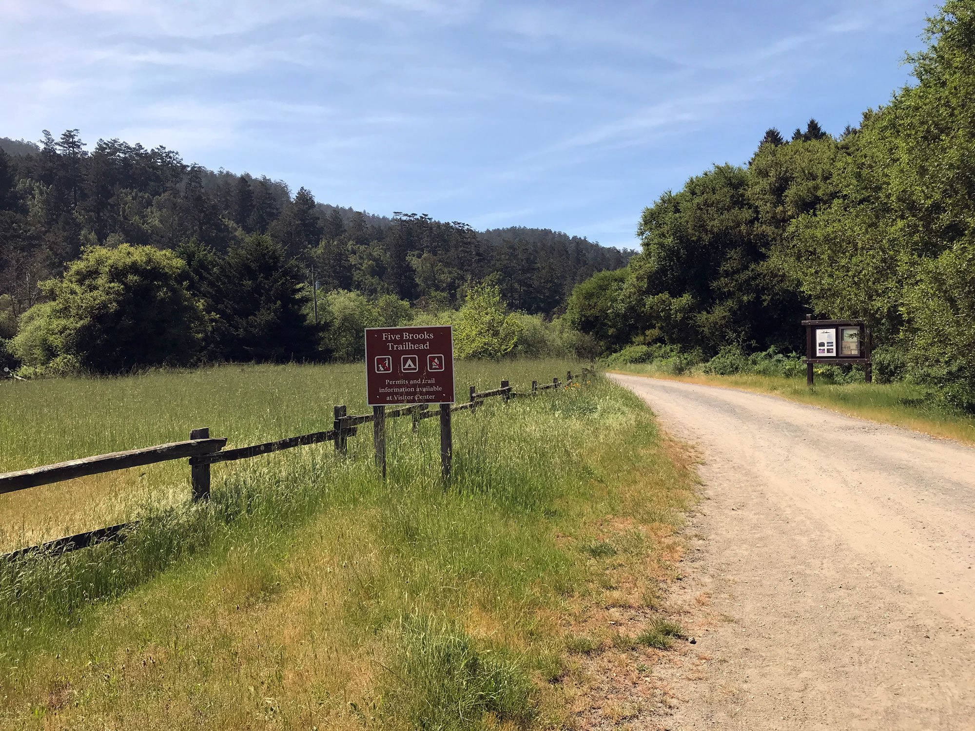
The Five Brooks Trailhead is located off Highway 1 (aka Shoreline Highway) 4.4 miles south of the Bear Valley Visitor Center. Three trails begin at this trailhead: the Olema Valley Trail, Stewart Trail, and Rift Zone Trail. The Stewart Trail connects with the Greenpicker, Ridge, Alamea, Old Out Road, Glen, and Coast trails along the way. The Olema Valley Trail connects with the Bolema Trail.

Five Brooks Ranch nearby offers horse rides. Also near the trailhead is a mill pond surrounded by willows and trees — it’s a great place to bird watch. Take the trail around the pond and rest at the picnic table at the edge of the pond. There are two vault toilets at the edge of the parking lot.

The Five Brooks Trailhead offers a good alternative to the Palomarin Trailhead, especially when the parking lot at Palomarin is full or if you want to bike part of the trail. You can bike to WildCat Camp and walk along the beach to Alamere Falls. You will be going up and over the Inverness Ridge so it’s a strenuous ride.

Hikes

  • Hike to Wildcat Campground & Beach, roundtrip (13.4 miles), strenuous - This link to the NPS website includes several possible routes and detailed directions. 

  • Bike to Wildcat Campground, roundtrip (13.4 miles), strenuous (link to the NPS website)

  • Hike to Alamere Falls, roundtrip (15.6 miles), strenuous (link to the NPS website)

  • Hike the Rift Zone Trail, roundtrip (8.6 miles), moderate (link to the NPS website) - The Vedanta Society Property, which the Rift Zone Trail enters ~1 mile (~1.6 km) north of the Five Brooks Trailhead, is only open to the general public from 8 am until 2 hours before sunset.

  • Hike the Stewart Trail Long Loop (11.6 miles with a shorter option), moderate to strenuous

  • Hike the Five Brooks Loop (5.7 miles), moderate

  • Walk around the mill pond, easy

Parking

The Five Brooks Trailhead parking lot is approximately 10 minutes by car from the Bear Valley Visitor Center. The last 0.3 miles is an unpaved road that is often severely potholed and washboarded. There is a large gravel parking lot at the end of the road.

Bikes, Pets, Drones, and other regulations

Learn more about this trail including Point Reyes National Seashore park regulations on the Five Brooks Trailhead page.

Kehoe Beach Trailhead

The Kehoe Beach Trailhead is located along Pierce Point Road between Abbotts Lagoon and the Tomales Point Trail. Kehoe Beach Trail is a short pet-friendly trail that leads to the beach. It’s a favorite trail with local dog owners. At low tide, explore the tide pools. Kehoe Beach has interesting geology and is known to have Peregrine falcons living in the cliffs. A vault toilet at the trailhead is available.

Hikes

Parking

Space for parking at the Kehoe Beach Trailhead consists of unpaved shoulders along the sides of Pierce Point Road 5.6 miles from its junction with Sir Francis Drake Boulevard. This trailhead is approximately 25 minutes by car from the Bear Valley Visitor Center. Space is limited.

Bikes, Pets, Drones, and other regulations

Learn more about this trail including Point Reyes National Seashore park regulations on the Kehoe Beach Trailhead page.

Kule Loklo Trailhead

The Kule Loklo Trailhead is located near the Bear Valley Visitor Center's paved parking lot. The Kule Loklo Trail leads to a replica Coast Miwok Indian village. It’s a great trail for young kids. Kule Loklo is located in a large meadow and has a picnic area and several shade trees - a perfect area for kids to explore. There are restrooms just outside the Bear Valley Visitor Center and in the large gravel parking lot near the picnic area and a vault toilet at Kule Loklo.

Hikes 

  • Walk or bike the Kule Loklo Trail, roundtrip (0.8 miles), easy

Parking

The paved parking lot has ~50 spaces. Hikers are encouraged to park in the large gravel parking lot which has room for ~210 vehicles. Parking is free. Pull-through spots are available for oversized vehicles, such as RVs and horse trailers, on the west (right) side of the access road past the visitor center.

Bikes, Pets, Drones, and other regulations

Learn more about this trail including Point Reyes National Seashore park regulations on the Kule Loklo Trailhead page.

Laguna Trailhead

The Laguna Trailhead is near the Point Reyes Hostel, Clem Miller Environmental Center and a short walk to the Coast Trailhead. This is the nearest trailhead to Coast Camp and a good starting point for the Laguna-Coast Loop and other coastal trail connectors. Alternatively, you can head uphill on the Laguna Trail into the forest toward Inverness Ridge and the Sky Trail.

Hikes

Parking

The Laguna Trailhead parking lot is approximately 15 minutes by car from the Bear Valley Visitor Center. There is a small paved parking lot with space for 13 vehicles across a small bridge near the east end of Laguna Road 0.5 miles from Limantour Road. Overflow parking is allowed in the grassy field on the south side of Laguna Road west of (before) the turn that leads to the Laguna Trailhead.

Bikes, Pets, Drones, and other regulations

Learn more about this trail including Point Reyes National Seashore park regulations on the Laguna Trailhead page.

Limantour Beach Trailhead

Limantour Beach Trailhead is located at the end of Limantour Road, a short walk from the beach parking lot and near the picnic area and vault toilets. Both hikes that start from this trailhead are flat and easy to hike. The Muddy Hollow Trail is great for kids. This is a prime spot to see shorebirds and water fowl at the beach, in the Estero de Limantour, and along Muddy Hollow Creek. Take a hike and then relax on the beach.

Suggested Routes From This Trailhead

Hike the Limantour Spit Trail, out and back (2 miles), easy
Hike the Muddy Hollow Trail, out and back (3.0-3.6 miles), easy - Turn around at the end of the dirt trail (near the utility buildings) or continue on the wider gravel road to the Muddy Hollow Trailhead for another 0.3 miles each way.

Parking

The Limantour Beach Trailhead parking lot is approximately 20 minutes by car from the Bear Valley Visitor Center. There is a very large gravel parking lot with space for ~200 vehicles at the west end of the Limantour Road.

Bikes, Pets, Drones, and other regulations

Learn more about this trail including Point Reyes National Seashore park regulations on the Limantour Beach Trailhead page.

Marshall Beach Trailhead

The Marshall Beach Trailhead is located at the north end of the unpaved L Ranch Road, which branches off of Pierce Point Road. You are likely to encounter cattle and the road can be very bumpy. The expansive view from the road extends far across the pasture to the ocean. The Marshall Beach Trail crosses the pasture for 1.2 miles as it descends ~350 feet in elevation to Marshall Beach on the shore of Tomales Bay. Alternatively, hike 0.9 miles to Lairds Landing which descends ~300 feet in elevation. Enjoy spring and summer wildflowers nestled in the grasses.

Hikes

  • Hike or bike the Marshall Beach Trail, out and back (2.4 miles), moderate

  • Hike to Lairds Landing, out and back (1.8 miles), moderate

  • Marshall Beach-Lairds Landing loop (~3.0 miles), moderate - In a very low tide, you can walk between Marshall Beach and Lairds Landing by carefully climbing along the edge of protruding rocks and walking along the sandy and rocky shoreline.

Parking

The Marshall Beach Trailhead parking lot is approximately 25 minutes by car from the Bear Valley Visitor Center. There is a dirt parking lot at the north end of L Ranch Roadside of Pierce Point Road 2.6 miles from its junction with Pierce Point Road. Overnight parking is not permitted.

Bikes, Pets, Drones, Camping, and other regulations

Learn more about this trail including park regulations on the Point Reyes National Seashore Marshall Beach Trailhead page.

McClures Beach Trailhead

The McClures Beach Trailhead is located at the end of Pierce Point Road on a short paved road that branches off downhill and to the west (left) just before the historic Pierce Point Ranch. The McClures Beach Trail is a short, but moderately steep, 0.4-mile walk to the ocean. McClures Beach is as dangerous as it is beautiful. Check the tides before visiting. The beach is narrow in places and is regularly pounded by rough ocean surf including sneaker waves. Vault toilets are available in the parking lot.

Hikes

Hike the McClures Beach Trail, out and back (0.8 miles), moderate

Parking

The McClures Beach Trailhead parking lot is approximately 35 minutes by car from the Bear Valley Visitor Center. There is a paved parking lot that can accommodate ~25 vehicles at the west end of a spur road heading downhill and to the west from the Tomales Point Traihead/Pierce Point Ranch parking lot. On busy weekends and holidays, the parking lot may be full by 10 am. RVs and buses will have difficulty turning around and are not recommended to be driven to Tomales Point.

Bikes, Pets, Drones, and other regulations

Learn more about this trail including Point Reyes National Seashore park regulations on the McClures Beach Trailhead page.

McCurdy Trailhead

The McCurdy Trailhead is located on the east side of Highway 1 (aka Shoreline Highway) 8.3 miles south of Olema and across the road from the Olema Valley (South) Trailhead. The McCurdy Trail is a very steep old ranch/fire road that ascends 2 miles through chaparral and some woodlands to the Bolinas Ridge Trail.

Suggested Routes From This Trailhead

  • Hike or bike to the Bolinas Ridge Trail, out and back (4 miles), strenuous

  • Hike or bike to the south end of the Bolinas Ridge Trail, out and back (x miles), strenuous

  • Hike or bike the McCurdy–Bolinas Ridge–Randall–Olema Valley loop: 8.6 miles roundtrip, strenuous

Parking

Limited parking is available for fewer than ~6 cars at the Olema Valley Trailhead (South) across the street from the McCurdy Trailhead. Park on the shoulder on the west side of Highway 1 (aka Shoreline Highway) 8.3 miles south of Olema. This trailhead is approximately 20 minutes by car from the Bear Valley Visitor Center. Please make sure your parked vehicle is completely off the highway and entirely out of the lane of travel.

It’s easy to miss the McCurdy and Olema Valley trailheads when driving along Shoreline Highway. If you’re coming from Bolinas, they are not far after Horsehill Rd near Dogtown. The Olema Valley Trailhead is on the left and the McCurdy is on the right. Drive slowly and pay attention. Some of the map applications give you the wrong directions for McCurdy Trail.

Bikes, Pets, Drones, and other regulations

Learn more about this trail including Point Reyes National Seashore park regulations on the McCurdy Trailhead page.

While designated as part of Golden Gate National Recreation Area, the McCurdy Trailhead, the McCurdy Trail, and the other trailheads and trails east of Highway 1 are managed by Point Reyes National Seashore.

Muddy Hollow Trailhead

The Muddy Hollow Trailhead is located on a short gravel road off Limantour Road. Two trails depart from this trailhead, the Muddy Hollow Trail and the Muddy Hollow Road Trail. The Muddy Hollow Trail leads to the Limantour Beach trailhead and connects with the Estero Trail. The longer Muddy Hollow Road Trail heads west and connects with the Bayview, Bucklin, Glenbrook, and White Gate trails.

Hikes

  • Hike the Muddy Hollow Trail, out and back (3.0-3.6 miles), easy - optional, spend time at Limantour beach

  • Hike the Muddy Hollow Loop, (7.4 miles), moderate

  • Hike the Bayview–Inverness Ridge–Drakes View Loop, (6.1 miles), strenuous

Parking

Muddy Hollow Trailhead is located at the west end of Muddy Hollow Road. The Muddy Hollow Trailhead parking lot is approximately 15 minutes by car from the Bear Valley Visitor Center. There is a small dirt parking lot with space for ~15 vehicles at the west end of the Muddy Hollow Road 0.2 miles from Limantour Road.

Bikes, Pets, Drones, and other regulations

Learn more about this trail including Point Reyes National Seashore park regulations on the Muddy Hollow Trailhead page.

Olema Valley (Hagmaier) Trailhead

The Olema Valley (Hagmaier) Trailhead is located on the west side of Highway 1 (aka Shoreline Highway) 6 miles south of Olema and across from the Randall Trailhead. This trailhead is about midpoint between the northern end at Five Brooks Trailhead and its southern end at the Olema Valley (South) Trailhead. From the trailhead, follow the Randall spur trail for 0.5 miles to connect to the Olema Valley Trail. The Olema Valley Trail intersects with the Teixeira Trail (to the south) and the Bolema and Stewart trails (to the north), all of which lead up to the Ridge Trail along the crest of Inverness Ridge.

Pine Gulch Creek crosses the Olema Valley Trail in two places on the south end. Once on the way from the Olema Valley (South) Trailhead just before the Teixera Trail, and again another 20 minutes walk north. The creek is shallow and easily crossed in summer but too deep to cross without soaking your hiking boots in winter. Keep the creek in mind when hiking a loop that includes the Teixera Trail.

Hikes

  • Hike to the Bolema Trail, out and back (3.6 miles) - easy

  • Hike to the mill pond at Five Brooks, out and back (6.0 miles) - moderate (vault toilets at the Five Brooks Trailhead)

  • Cross the street to hike or bike the Randall–Bolinas Ridge–McCurdy–Olema Valley loop: 8.6 miles (13.8 km) roundtrip, strenuous - you will cross Pine Gulch Creek twice.

  • Hike the Olema Valley–Bolema-Ridge-Teixeira loop (10.1 miles), strenuous - You’ll cross Pine Gulch Creek without a bridge about 2 miles from the end of this loop.

Parking

Parking at the Olema Valley (Hagmaier) Trailhead is along the unpaved shoulders on both sides of Highway 1 (aka Shoreline Highway) 6 miles south of Olema. This trailhead is approximately 15 minutes by car from the Bear Valley Visitor Center. Please make sure your parked vehicle is completely off the highway and entirely out of the lane of travel. Parking is shared with the Randall Trailhead which is across the road.

Bikes, Pets, Drones, and other regulations

Learn more about this trail including Point Reyes National Seashore park regulations on the Olema Valley (Hagmaier) Trailhead page.

Olema Valley (South) Trailhead

The Olema Valley (South) Trailhead is located on the west side of Highway 1 (aka Shoreline Highway) 8.3 miles south of Olema and across the road from the McCurdy Trailhead. The Olema Valley Trail intersects with the Teixeira Trail and the Bolema and Stewart trails which lead west up to the Ridge Trail along the crest of Inverness Ridge. It also intersects with a short 0.5-mile-long connector trail that leads to the Randall Trailhead across the road.

Pine Gulch Creek crosses the Olema Valley Trail in two places on the south end. Once just before the Teixera Trail, and again another 20 minutes walk north. The creek is shallow and easily crossed in summer but too deep to cross without soaking your hiking boots in winter.

Hikes

  • Hike to Pablo Point, out and back (5.4 miles) - hike this loneliest of trails in fall/winter when the poison oak is dormant

  • Hike the Teixeira Trail, out and back (3.4 miles)

  • Hike or bike the Olema Valley-Randall-Bolinas Ridge-McCurdy loop (8.6 miles), strenuous

  • Hike the Olema Valley-Bolema-Ridge-Teixeira loop (10.1 miles), strenuous

Parking

Limited parking is available for fewer than ~6 cars at the Olema Valley Trailhead (South). Park on the shoulder on the west side of Highway 1 (aka Shoreline Highway) 8.3 miles south of Olema. This trailhead is approximately 20 minutes by car from the Bear Valley Visitor Center. Please make sure your parked vehicle is completely off the highway and entirely out of the lane of travel.

It’s easy to miss the Olema Valley trailhead when driving along Shoreline Highway. If you’re coming from Bolinas, it’s right after Horsehill Rd and near Dogtown. The Olema Valley Trailhead is on the left and the McCurdy Trailhead is on the right. Drive slowly and pay attention. Some map applications give you the wrong directions for this area.

Bikes, Pets, Drones, and other regulations

Learn more about this trail including Point Reyes National Seashore park regulations on the Olema Valley (South) Trailhead page.

Palomarin Trailhead

THIS IS THE NPS LANGUAGE The Palomarin Trailhead is located at the northwestern end of Mesa Road, approximately 5 miles northwest of Bolinas. It is the southern end of the popular Coast Trail and the starting point for visits to Bass Lake, Wildcat Camp, and Alamere Falls. Between Palomarin Trailhead and Wildcat Campground, the Coast Trail connects with Lake Ranch Trail, Ocean Lake Loop Trail, Old Out Road Trail, and Stewart Trail.

Hikes

Hike to Bass Lake (NPS website), out and back (5.2 miles), moderate
Hike to Wildcat Beach (NPS website) out and back (11 miles), moderate
Hike to Alamere Falls (NPS website) out and back (13 miles), strenuous

Bikes are not permitted on any trails leaving from the Palomarin Trailhead.

Pets are not permitted.

Parking

The Palomarin Trailhead parking lot is approximately 35 minutes by car from the Bear Valley Visitor Center. The last 1.2 miles of Mesa Road is unpaved and is often severely potholed and washboarded. There is a gravel parking lot at the end of the road.

Please be aware that on weekends throughout the year and on many weekdays throughout the summer, the parking lot at the Palomarin Trailhead fills very early in the day. Visitors arriving late in the morning or in the afternoon may be turned away. The park will close the Palomarin area to further entry, potentially for several hours, when there are no more parking spaces available in the parking lot. Please observe all "No Parking" signs. If you wish to visit locations accessed via the Palomarin Trailhead, arrive early, or consider visiting mid-week.

Bikes, Pets, Drones, and other regulations

Learn more about this trail including Point Reyes National Seashore park regulations on the Palomarin Trailhead page.

Point Reyes Hill Trailhead

The Point Reyes Hill Trailhead is located at the southern end of Mount Vision Road and the north end of the Inverness Ridge Trail. Mount Vision Road, paved from the parking lot to the Inverness Ridge Trail, is a pleasant and scenic 0.4 mile walk with ocean views on a clear day. It ends at the Inverness Ridge Trail which follows the ridge crest south to Limantour Road and intersects with trails that descend to Muddy Hollow — the Bucklin and Drakes View trails. The winding drive to the top of Mount Vision offers spectacular views of the surrounding land and ocean including a bird’s eye view of the Cypress Tunnel.

Hikes

  • Hike to the top of Point Reyes Hill, out and back (1 mile), easy
    Follow Mount Vision Road for 0.4 miles, then turn right onto the Bucklin Trail for 480 feet to a bench with a view and a picnic table nearby sometimes hidden in tall grasses. Bikes are permitted on the Inverness Ridge Trail, but not on the Bucklin Trail.

  • Hike the Bucklin Trail, out and back (5.4 miles), strenuous

  • Hike the Bucklin–Muddy Hollow Road–Drakes View–Inverness Ridge loop, (7.7 miles), strenuous

  • Hike the Bucklin–Muddy Hollow Road–Bayview–Inverness Ridge loop, (8.6 miles), strenuous

  • Bike the Inverness Ridge Trail to Bayview Trailhead, out and back (6 miles), strenuous

Parking

The Point Reyes Hill Trailhead parking lot is approximately 40 minutes by car from the Bear Valley Visitor Center. There is a dirt parking lot with space for ~30 vehicles at the south end of Mount Vision Road 3.8 miles from Sir Francis Drake Boulevard.

  • Mount Vision Road is a two-way, one lane wide with sharp switchbacks and does not have many good places to pull off. Drive slowly and cautiously.

  • Vehicles more than 24 feet in length and vehicles pulling trailers are prohibited from using Mount Vision Road. If you are traveling with a trailer or are driving an RV towing a passenger vehicle, consider unhitching at the bus/RV/trailer-only parking lot at Bear Valley and taking only the passenger vehicle for the drive out to the trailhead.

  • Mount Vision Road is closed when the fire danger is high, very high, or extreme. Call the park's Fire Danger information line at 415-464-5100 x2 x1 to learn what today's fire danger rating is.

Bikes, Pets, Drones, and other regulations

Learn more about this trail including Point Reyes National Seashore park regulations on the Point Reyes Hill Trailhead page.

Randall Trailhead

The Randall Trailhead is located on the east side of Highway 1 (aka Shoreline Highway) 6 miles south of Olema and across from the Olema Valley (Hagmaier) Trailhead. The Randall Trail is a fairly steep old ranch/fire road that ascends 1.7 miles through Douglas fir and coast redwood forests to the Bolinas Ridge Trail. Pets (on a six-foot or shorter leash), bicycles, and horses are permitted on the Randall Trail and on the other trails in this section of Golden Gate National Recreation Area (e.g., the trails east of Highway 1). While designated as part of Golden Gate National Recreation Area, this area is managed by Point Reyes National Seashore.

Hikes

  • Hike to the Bolinas Ridge Trail and back, out and back (3.4 miles), strenuous

  • Hike or bike the Randall–Bolinas Ridge–McCurdy–Olema Valley loop, (8.6 miles), strenuous

Parking

Space for parking at the Randall Trailhead consists of unpaved shoulders along both sides of Highway 1 (aka Shoreline Highway) 6 miles south of Olema. This trailhead is approximately 15 minutes by car from the Bear Valley Visitor Center. Please make sure your parked vehicle is completely off the highway and entirely out of the lane of travel.

Bikes, Pets, Drones, and other regulations

Learn more about this trail including Point Reyes National Seashore park regulations on the Randall Trailhead page.

Sky Trailhead

Hike along the Inverness Ridge through mixed fir forests to the ocean

NPS language: The Sky Trailhead, located on Limantour Road, serves as the northern terminus of the Sky Trail and the eastern end of the Bayview Trail. The Sky Trail heads south through Douglas fir forest and connects with the Fire Lane, Horse, Mount Wittenberg, Meadow, Woodward Valley, Old Pine, Baldy, and Coast trails. Much of this area burned during the Woodward Fire of 2020.

There are many potential routes and loops available, whether you want to stay along the spine of the ridge, or descend to the coast or to the Bear Valley area. The habitat changes from forest to coastal scrub or mixed woodland, depending on your route.

Hikes

  • Hike to Mount Wittenberg (NPS website), out and back (4.6 miles), moderate

  • Hike the Sky–Woodward Valley–Fire Lane Loop (NPS website), (9.5 miles), strenuous, Starting at the Sky Trailhead, hike to Woodward Valley Trail (2.6 miles). Hike the Woodward Valley Trail to the Coast Trail (2.0 miles). Turn right on the Coast Trail toward the Fire Lane Trail (0.8 miles). Take the Fire Lane Trail back to the Sky Trail (3.3 miles). Turn left on the Sky Trail to return to the trailhead (0.8 miles).

  • Hike or bike to Sky Campground (NPS website), out and back (2.8 miles), moderate, bikes are not permitted beyond Sky Campground or on any other trails in the area

Parking

The Sky Trailhead parking lot is approximately 10 minutes by car from the Bear Valley Visitor Center. There is a small gravel parking lot with space for ~10 vehicles on the south side of Limantour Road 3.4 miles from its junction with Bear Valley Road. A limited amount of overflow parking is available on the shoulders of Limantour Road near the trailhead lot.

Bikes, Pets, Drones, and other regulations

Learn more about this trail including Point Reyes National Seashore park regulations on the Sky Trailhead page.

Tomales Bay Trailhead

An easy walk with views of Tomales Bay and the forested slopes of Inverness Ridge

The Tomales Bay Trailhead is located on the east side of Tomales Bay. The Tomales Bay Trail is an easy walk through pastureland with grazing cattle. The trail winds past two ponds filled with birds, featuring red-winged blackbirds as well as croaking frogs. The trail climbs up and over a gently sloping hill providing a panoramic view of Tomales Bay to the edge of the restored Giacomini Wetlands.

While officially part of Golden Gate National Recreation Area, the Tomales Bay Trail is managed by Point Reyes National Seashore.

Hikes

  • Hike the Tomales Bay Trail, lollipop loop (3.4 miles), easy. Hike on the trail to the cattle gate at the second pond, turn right and go around the hill rather than going up the hill. Return up and over the hill back to the gate and then back to the trailhead.

Parking

The Tomales Bay Trailhead parking lot is located immediately west of Highway 1 1.2 miles (1.9 km) north of the Point Reyes–Petaluma Road junction and approximately 10 minutes by car from the Bear Valley Visitor Center. The parking lot is unpaved and has space for about 15 vehicles.

Bikes, Pets, Drones, and other regulations

Learn more about this trail including Point Reyes National Seashore park regulations on the Tomales Bay Trailhead page.

Tomales Point Trailhead

The Tomales Point Trailhead is located at the north end of Pierce Point Road. The Tomales Point Trail is one of the most dramatic and popular hikes in the seashore. On a clear day, you can see the ocean on one side of the trail and Tomales Bay on the other. Spring time offers wildflowers and baby Tule Elk sheltering in tall grasses. Late summer and fall feature Tule Elk battling for dominance in the annual rut. Winter is a great time to visit when days are often bright and free of fog.

Hikes

Parking

The Tomales Point Trailhead parking lot is approximately 35 minutes by car from the Bear Valley Visitor Center. There is a dirt parking lot at the north end of Pierce Point Road that can accommodate 20 vehicles. On busy weekends and holidays, the parking lot may be full by 10 am. If you park along the Pierce Point Road south of the parking lot, please observe all "No Parking" signs and ensure that no part of your parked vehicle is on the pavement in order to allow other vehicles to safely pass. Please park perpendicular to the road where possible. Be aware that the shoulders along Pierce Point Road are often soft during the winter and spring and vehicles have become stuck in the mud when their owners attempted to park along the road. RVs and buses may have difficulty turning around and are not recommended to be driven to Tomales Point.

Bikes, Pets, Drones, and other regulations

Learn more about this trail including Point Reyes National Seashore park regulations on the Tomales Point Trailhead page.